Watermark-PNG - Edited

Bird's Eye View: Aerial Imagery Redefined

At Bird's Eye View, we provide exceptional drone photography services that elevate the way you showcase your property and projects. Our expertise is rooted in high-quality aerial imagery tailored for various applications, ensuring an engaging experience for all visitors.

Contact Us
Professional Drone Pilots

Our pilots combine extensive experience with creativity to deliver work you can trust.

Quality You Can See

We use the latest drone and camera technology to capture stunning, high-resolution images and video.

Flexible and Reliable

We understand deadlines and budgets. Our services are tailored to your needs, and we deliver when we say we will.

About Bird's Eye View

Bird’s Eye View was founded in Auckland with one goal, to help people see their projects from a whole new perspective.

What started as a passion for flight and photography has grown into a trusted aerial imagery service known for precision, creativity, and reliability. Every shoot is handled personally, from planning and compliance through to capture and delivery. That means you get a seamless experience, consistent quality, and imagery that genuinely reflects your vision.

At Bird’s Eye View, it’s not just about taking photos from above, it’s about revealing the full story of what’s happening on the ground.

Learn More

Our Services

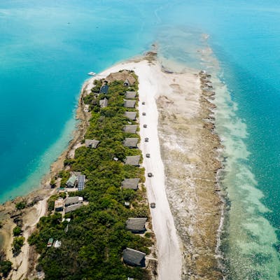
Discover our comprehensive range of drone services designed for real estate, construction, and marine industries. We're committed to delivering exceptional imagery and data to suit your unique requirements.

2D and 3D Mapping

Create accurate maps and 3D models to support planning, analysis, and decision-making.

Aerial surveying

Capture large areas quickly and cost-effectively with precise aerial data.

Marine Imagery

Showcase yachts, boats, and marine events with dynamic imagery from above.

Construction Progress Monitoring

Track and document builds with regular aerial updates that improve project visibility and reporting.

Real Estate 

Present properties with stunning aerial photography and video that attract buyers and highlight key features.

Inspections 

Safely assess roofs, structures, and hard-to-reach assets without the need for scaffolding or lifts.

manish-tulaskar-Xkn1B3PrNqQ-unsplash - Edited
Learn about our seamless process in delivering exceptional aerial imagery, ensuring quality and timeliness in every project.

Our Workflow Process

1

pexels-photo-34109834
Step 1: Consultation

We discuss your goals and create a clear brief.

2

Step 2: Flight Planning

We map flight paths, confirm compliance, and plan for the best light and angles.

Step 3: Aerial Imaging

We shoot, edit, and deliver your imagery quickly, ready for use across print or digital.

3